


Korpelia
Stockevik, Skaftö
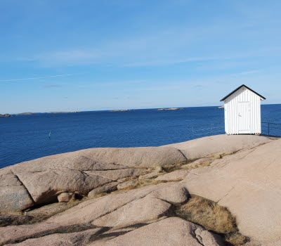
Korpelia is an adventurous walking path of about 1 km from the meadow at Gröder Hamn over the mountain and down to the harbour at Stockevik on Skaftö.
Quick facts
Length: 1 km
Timing: 15 minutes
Difficulty: Demanding
Terrain: Level differences and steep passages where good condition is required. carved steps and ropes to hold on to.
Korpelia
The footpath leads over the mountain called Korpeberget, which means the mountain with ravens. Lia is an old name for lid and lid means steep road and that is exactly what this hiking trail is, hence the name. Korpelia was inaugurated on Midsummer Day 2018 with over 70 people who joined in for the festive and sunny inauguration on the meadow at Gröder Hamn. Sven Laurell, chairman of Skaftö Öråd, cut the ribbon and gave the opening speech.
Stone steps and ropes at steep and narrow passages
The association Munkeviksleden initiated this footpath. It starts on the meadow at Gröder Hamn and winds its way up the mountain Korpeberget and away towards Stockevik. There are stone steps and ropes to hold on to at steep and narrow passages. There is a bench halfway up the mountain where you can sit down to catch your breath, have coffee and enjoy the vue of the Gåsö fjord and the bay at Gröderhamn.
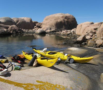
Reference bay for rubbish at the bay Gröderhamn
The bay at Gröderhamn is a reference beach, ie the Swedish Agency for Marine and Water Management measure the amount of marine debris three times a year in this bay, when they also clean the bay. To give the right base for research, do not bring any of the rubbish in the bay, but feel free to clean other beaches.
Fact about the trail
Length:
1 km
Approximate times:
15 minutes
Marking:
Wooden sticks marked with yellow paint and yellow dots painted on the rocky ground
Level of difficulty:
Demanding with a steep rocky climb. The hiking trail is well tended to. There are railings with ropes where the terrain is challenging, steep and narrow.
Start and end:
Start at the meadow Gröderhamn
End at the harbour in Stockevik, Skaftö.
How to get here:
In Gröderhamn and Stockevik, parking spaces are limited during summer. The best way to get here is by bike or on foot. Gröderhamnsvägen leads down to the meadow at Gröderhamn where the trail starts. You can also walk the hiking trail from Stockevik.
Map:
You can find a route map on Google maps and if you want a printed map, it is available at Infopoints in Lysekil municipality.
If you are interested in more scenic hikes on Skaftö - check out Skaftö – en livslång kärlek with a map which is also printable.

