


Munkevik hiking trail
Åseberget-Vigerna, Skaftö
Munkevik hiking trail begins at the cemetary Kolerakyrkogården below Åseberget and winds its way through the forest down to Munkevik wherefrom it continues along the coastal strip and ends at Vigerna where the wooden walk Strandpromenaden takes over.
Quick facts
Length: 1.7 km
Timing: 30 min
Difficulty: Moderate
Terrain: Mostly nature trail with wooden footbridges, steps and handrails at difficult passages
From Munkevik hiking trail to the wooden walk Strandpromenad
Munkevik hiking trail is a medium-hard hiking trail. It starts at the cemetary Kolerakyrkogården below Åseberget and winds its way through the forest down to Munkevik wherefrom it continues along the coastal strip to Vigerna. At Vigerna bathing place you can stop for a swim. After that, the wooden walk Strandpromenaden takes over, past Skäddhålan and then ends in Grundsund. It is a hike of about 5 kilometers. Munkevik hiking trail is marked with yellow dots and from Åseberget to Vigerna it is about 1,7 km.
Hiking with wooden steps and railing of ropes at difficult passages
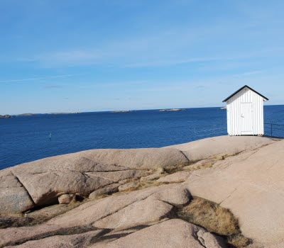
Walk at your own pace in the forest and along the rocky shoreline with a view of Gåsö. At wet passages there are footbridges, in steep sections there are wooden steps or railings with ropes. The Munkevik association maintains and improves the hiking trail. There are large giant pots at the rocky edge by a small bay and earth-filled giant pots in a forest area near Vigerna.
Fact about the trail
Length:
1,7 km
Approximate times:
30 minutes
Marking:
Wooden sticks marked with yellow paint and yellow dots painted on the rocky ground
Level of difficulty:
The hiking trail is a nature trail through woods and over cliffs. In some wet places there are wooden footbridges and at challenging climbs wooden steps and railings with ropes.
Start and end:
Start near the old cemetery below Åseberget. There are big signs and an overview map at the start of the trail.
The hiking trail ends at a wooden sign indicating Munkeviksleden placed by a small crossroads leading down to Vigerna bathing area.
How to get here:
From Grundsund and Stockevik you can walk or cycle to the foot of Åseberget along the coastal path. The hiking trail Munkevik starts near the old cemetery. You can also access the hiking trail Munkevik from the other direction. Then the easiest way is via Strandpromenaden to Vigerna bathing area and access the end of the hiking trail from there.
Map:
You can find a route map on Google maps and if you want a printed map, it is available at Infopoints in Lysekil municipality.
If you are interested in more scenic hikes on Skaftö - check out Skaftö – en livslång kärlek with a map which is also printable.

