


Härmanö hiking trails
Gullholmen, Orust
Härmanö is one of the largest nature reserves in Bohuslän. Rich in natural beauty, with several walking trails, it offers plenty for both day trippers and experienced hikers. If you like a challenge, take the trail to the highest point on the southern tip of the island, Härmanö Huvud, with its spectacular views.
Quick facts
Length: 2.5 - 5 km
Difficulty: easy - hard
Terrain: gravelled roads, hilly paths, boardwalks
Walk through picturesque fishing villages and a large nature reserve
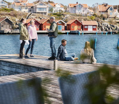
The settlement of Gullholmen, on the island of Härmanö, was originally a fishing village. In common with other places along Bohuslän’s coastline the catch they were after was the “silver of the sea”, herrings, a vital source of food. The herring shoals appeared and disappeared over the centuries and this had a marked effect on the area’s economy, population density and settlements. Gullholmen is Sweden’s most densely built up island. This combined with Härmanö, which is one of Bohuslän’s biggest nature reserves, creates a unique setting. Härmanö consists of two islands, Lilla Härmanö to the north, with the town of Gullholmen on it, and Stora Härmanö to the south.
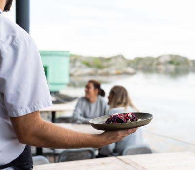
In the town there are a few restaurants and cafes that are open during summer. A bit further south is Gullholmsbaden, with cottage hire, a restaurant and sauna. You’ll find lovely spots to swim along the walking trails and the island is a mecca for birdwatchers. It’s a good place to see migratory birds and if you are lucky you might spot sea eagles, auks, common scoter, or ospreys.
If you feel like a longer hike then this is the perfect location. After you’ve left the town the nature reserve stretches out before you, with walking trails of differing lengths and grades of difficulty. If you walk all the way down to the island’s southern tip you’ll reach Härmanö Huvud, with unbeatable views.
Not had your fill of the western islands? Then don’t miss Käringön, just a boat ride away.
Fact about the trail
Length:
Gullholmen-Klippevik 4 km, Höpallen-Härm 2.5 km, Härm-Myren 4 km, Myren-Skålldalen 5 km, Skålldalen-Härmanö Huvud 3km.
From the ferry landing to Härmanö Huvud it’s approx. 8 km.
Level of difficulty:
The roads from the town of Gullholmen to Klippevik and the yellow Höpallen - Härm trail are accessible. There’s an accessible toilet at Grindebacken. The yellow trail is easily walked, but not suitable for wheelchairs. The blue trail from Härm is hilly in parts, but still accessible with wheelchairs. The white trail is difficult in parts and the blue trail to Härmanö Huvud is hilly.
We advise you to wear good shoes and bring a picnic with you on your hike. Distances are great and the terrain is uneven and often difficult to walk.
Start and end:
To get to the start of the hiking trails from the harbour where the ferry to Gullholmen lands, walk south through the town, past Gullholmsbaden. The brown trail starts in the town and follows the coast past Höpallen and Härm, then down to Klippevik. This trail is easily accessed by all, including wheelchair users. Almost all hiking trails lead off the brown trail which starts from here as a circular route. At Härm you can turn off on the yellow trail that goes uphill back to Höpallen. The blue trail goes from Härm down to Myren and back to Härm again. The white trail goes from Myren to Klippevik and all the way down to Härmanö’s headland. If you want to continue to Härmanö Huvud, follow the blue trail from here, otherwise continue along the white trail back to Myren.
All the trails follow on from each other, all the way from the ferry landing to Härmanö Huvud. When
How to get here:
Car: Exit the E6 to take road 160 Tjörn and Orust. After going over the Tjörn bridge continue straight ahead on road 160 to Orust. After 13 km you’ll get to Varekil, turn left to Ellös. After another 15 km turn left to Gullholmen. Follow the signs for Tuvesvik. Park in the designated car park and walk to the ferry terminal.
Tuvesvik-Gullholmen ferry: The ferry from Tuvesvik goes to both Gullholmen and Käringön. For timetables see Västtrafik's Travel Planner. Tickets can be purchased at the ferry terminal.
Public transport: See Västtrafik's Travel Planner.
Travel by bus on the Orust Express and 371 from Stenungsund’s station, to Tuvesvik. The journey takes around 1 hour.
Buses also leave from Henån’s bus terminal to Tuvesvik. The journey takes around 40 min.
Map:
Link to a map of Härmanö walking trails >>
Responsible for the trails: Orust District Council. Västkuststiftelsen manage the nature reserve.
Södra Bohuslän Turism
Fregatten 2
44430 Stenungsund
Phone: +46 303 833 27
E-mail: info@sodrabohuslan.com
Website: sodrabohuslan.com

