


The Sjuhärad Trail Stages 3-7
Olsfors - Prången
The Sjuhärad Trail is a 140 kilometre long distance walking trail through diverse landscapes and beautiful countryside, with several places worth seeing along the way. You’ll hike along varying surfaces through forests, farmland and small towns. Stages 3 to 7 can be walked as day trips, as public transport connections are good along these stretches.
Quick facts
Length: 74 km
Timing: this stretch is divided into five stages and is suitable for five day trips
Difficulty: moderate
Terrain: forests, farmland and towns
The Sjuhärad Trail – part of the E1 European Long Distance Path
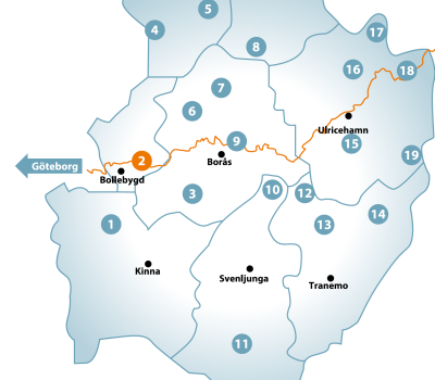
The Sjuhärad Trail starts in Hindås and goes via via Bollebygd, Borås and Ulricehamn to Mullsjö. The trail leads through five municipalities, is 140 km long and is divided into 10 stages. Our focus will be on stages 3-7, as they can be walked as day trips.
The Sjuhärad Trail has been part of the European Long Distance Path, the E1 which starts in Italy, since 1991. In Sweden the E1 stretches between Varberg and Grövelsjön. The Sjuhärad Trail also passes several other walking trails and exercise areas, including Kypegården in Borås, the Wilderness Trail (Vildmarksleden) and the Redväg Trail in Ulricehamn.
Ancient remains, beautiful views and old churches
The trail passes through many areas of outstanding natural beauty. Mölnebäcken on stage 3 has an interesting history, as several small flour mills have existed there for many hundreds of years. In Rya Åsar Nature Reserve on stage 4 you can immerse yourself in a real wilderness. You’ll find Raska Mina’s cottage on stage 6, a lovely croft from the 1800s, which is always open. The décor inside the croft is authentic, and you can eat your picnic on Raska Mina’s kitchen table.
You’ll also go past ancient farming remains, beautiful views and old churches along the trail. In stage 7 the ruins of Brunn’s church, which was probably built in the 12th century, are worth visiting. For more detailed information about what to see along the route see the stage descriptions further down.
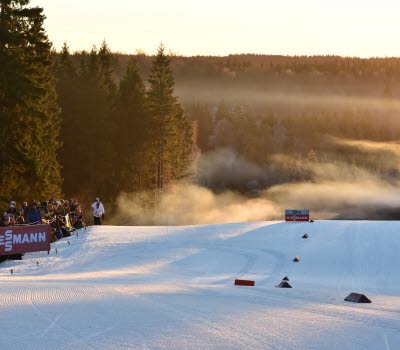
Photographer: Lukasz Warzecha
Stay in a hotel, hostel or outside
There are many lovely picnic areas with services, and other places to stop at and stay in along the route. Choose between hostel and hotel accommodation, or wild camping. There are several permanent shelters you can camp overnight in, however other kinds of indoor accommodation are not available on every stage of the trail.
In Borås in stage 5 the trail passes Borås Camping, where you’ll also find Borås Zoo and Upzone Adventure Park. There are lots of services here in the form of shops and places to eat, in Knalleland approx. 1 km from the trail.
In stage 7 in Ulricehamn there’s plenty of accommodation to choose from, including for example Hotel Bogesund. You’ll also find shops, restaurants and other services.
Fact about the trail
Length:
The stretch from Olsfors to Prången is 74 kilometres in total and can be split into five stages.
- Stage 3 - IK Omega sports club – SOK cottage: 10 kilometres
- Stage 4 - SOK cottage - Rya Åsar: 13 kilometres
- Stage 5 - Rya Åsar - Karlsaflogarna: 19 kilometres
- Stage 6 - Karlsaflogarna - Blackered: 20 kilometres
- Stage 7 - Blackered – Prången’s campsite: 12 kilometres
Approximate times:
The whole way from Olsfors to Prången works well split over five days. You’ll find an estimate of the respective stages’ walking times below:
- Stage 3 - IK Omega sports club – SOK cottage: 2.5 hours
- Stage 4 - SOK cottage - Rya Åsar: 3.5 hours
- Stage 5 - Rya Åsar - Karlsaflogarna: 6 hours
- Stage 6 - Karlsaflogarna - Blackered: 5.5 hours
- Stage 7 - Blackered – Prången’s campsite: 3 hours
Marking:
The trail is marked with orange signs and arrows.
Level of difficulty:
Overall the trail is classified as moderate but this varies greatly according to which part of the trail you are walking. There’s more detailed information below about the different stages.
- Stage 3 - IK Omega sports club - SOK cottage: This stage is classed as moderate and goes mostly through forests, with good walking surfaces under normal conditions.
- Stage 4 - SOK cottage - Rya Åsar: This stage is classified as hard because of the large height differences. Most of this stage is through forests. On the whole walking surfaces are good but there are shorter stretches which can be boggy or hard to walk, and walking boots or wellingtons are recommended even under normal conditions
- Stage 5 - Rya Åsar - Karlsaflogarna: This stage is very varied and is classified as hard. You will walk through towns, forests and farmland.
- Stage 6 - Karlsaflogarna - Blackered: This stage is classed as moderate. It is very varied and goes through forest and farmland. The part that is in the municipality of Borås is mostly on gravelled roads, and walking boots or wellingtons will only be necessary on a few short stretches under normal conditions. The part that goes through the municipality of Ulricehamn is almost completely on forestry roads and paths. Boots or wellingtons are recommended in some places even under normal conditions.
- Stage 7 - Blackered - Prångens camping: This stage is classified as moderate and is mostly through forest on forest roads. You will also pas through some some fields with grazing animals. Remember to close gates and leave livestock alone. The last 3.6 km of the walk are on an asphalted walking and cycling track. There are no serviced picnic areas along this stretch, but you will find many natural places to sit.
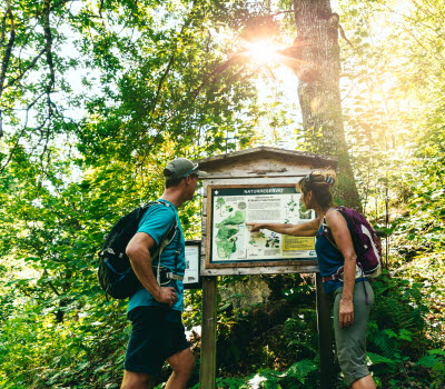
Photographer: Lukasz Warzecha
Start and end:
There are several ways to get to the trail using public transport. Suitable starting points are shown on maps for each respective stage.
- Stage 3 - IK Omega sports club – SOK cottage: There is both parking and a bus stop at Olsfors in the county of Bollebygd, where the trail starts. Top get there from Borås travel centre takes approximately 30 minutes by bus.
- Stage 4 - SOK cottage - Rya Åsar: There’s parking right next to the SOK cottage. The Skogshill Övre bus stop is 1.7 kilometres from the start of the stage, and regular buses leave from Borås travel centre, journey time approx. 20 minutes.
- Stage 5 - Rya Åsar - Karlsaflogarna: There’s parking right next to the start of the stage, and the Björbostugan bus stop is also around 500 metres away. It’s just a five minute bus ride from Borås travel centre.
- Stage 6 - Karlsaflogarna - Blackered: There’s parking in Karlsaflogarna right next to the start of the stage. The Häljaredsvägen bus stop is 500 metres to the north of the start, and the Toarp Church bus stop is around 500 metres to the south of the start. The bus journey from Borås travel centre takes around 30 minutes, changing at Dalsjöfors.
- Stage 7 - Blackered - Prångens camping: There’s parking right by the start of the stage. The nearest bus stop is Kommskälet, about 2 kilometres from the start. You can get to the trail sooner by walking some of stage 6 from here.
Photographer: Lukasz Warzecha
How to get here:
The Sjuhärad Trail starts in Hindås and goes via Bollebygd, Borås and Ulricehamn to Mullsjö. Stage 3 starts in the municipality of Bollebygd and then continues into the municipality of Borås. Stages 4 and 5 are in the municipality of Borås. Stage 6 starts in the municipality of Borås and continues into the municipality of Ulricehamn, where stage 7 also is. You can get to Borås travel centre by express bus, car or train in approximately 40 minutes from the centre of Gothenburg. From Borås travel centre you can easily get to the bus stops along the trail. It’s a journey of around 1 hour by car to Ulricehman from Gothenburg, and the bus takes 1 hour 50 minutes, changing at Borås.


