


Hiking in Vänerstad
Vänersborg
Hike in Vänersborg - the gateway to Lake Vänern. With this hiking map you can explore popular tourist destinations, beautiful nature and interesting history. The Hiking in Vänerstad map offers you on a 10 kilometer hiking trip with additional trails if you want to explore even more what Vänersborg has to offer.
Vänersborg and Lake Vänern
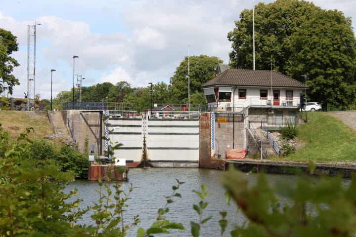
Vänersborg is a town surrounded by water. To the north is Sweden's largest lake, Lake Vänern, to the west is the Vassbotten bay connected to Lake Vänern, to the south is the canal Karl's grav and to the east is the Göta River that connects the waters of Lake Vänern with Kattegat and then the North Sea. Here pleasure boats and merchant ships travel north to Lake Vänern or south towards Trollhättan and then Gothenburg. On their way they pass through the three lock stairs in Göta River where the uppermost lock is in Vänersborg; Brinkebergskulle lock.
Birger Sjöberg, the town's most famous poet, dubbed his Vänersborg "Little Paris" and the town has a long and interesting history. Today Vänersborg is the regional capital of Västra Götaland County. Hiking in Vänerstad is a great way to experience the cultural history, the natural beauty and the idyllic small town feeling that Vänersborg is famous for.
What you will see along the way
The hike begins by the railway station and takes you along the waters of Vassbotten bay, past the guest harbor and the beautiful sculpture Andarnas skepp. Following the waters of Vassbotten bay you will come to the Karl's grav canal where the boat traffic to and from Lake Vänern travels. You can either go all along the canal down to the Brinkebergskulle lock or you can turn north after about halfway along the canal.
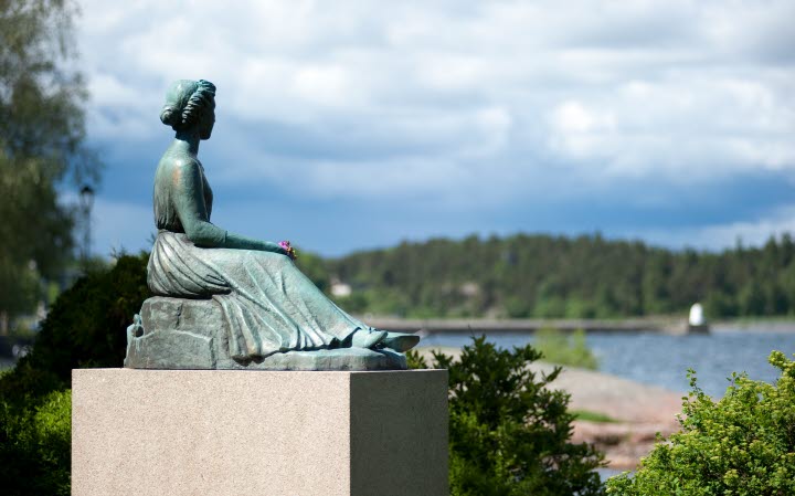
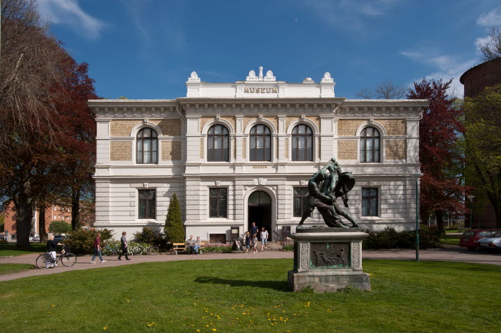
The hike will then take you through the outer areas of Vänersborg up to the beautiful Holmängen nature area. Here you will walk just along the shore of Lake Vänern. Further on you will arrive to Skräckle Park, a popular park just on the shore of Lake Vänern. Feel free to take a dip in Lake Vänern here or sit down at the cafe Skräcklestugan that is open during the summer. Here you can also see the sculpture of Birger Sjöberg's muse Frida, looking out over the water towards Dalbo Mountain, where Birger Sjöberg and his friends often stayed. The hike ends at the so-called Cultural Axis, where you can see the old Residence building, Vänersborg Square, the Plantaget park, Vänersborg Church and Vänersborg Museum - Sweden's oldest museum environment, a British Museum in miniature.
For those of you who want to see even more
Hiking in Vänerstad offers more for those who want to explore even more of Vänersborg. The red dotted line is the previously described main hike but the blue dotted lines are additional hikes. You can explore Nygårdsängen nature reserve on the banks of Vassbotten bay, hike along Karl's grav canal down to the Brinkebergskulle lock, explore the sculpture park at Restad gård just east of Brinkebergskulle or visit Lillån, a small tributary to Göta river in the eastern part of Vänersborg.
If you want even more than that you can cross Dalbobron bridge in the western part of central Vänersborg and walk north along the shore of Lake Vänern along the Dalbo trail, a 4 kilometer long trail that takes you all the way up to Ursand camping.
Map
If you would like to have a printed map with you it is available at the Vänersborg Tourist Office for only 20 SEK. A digital version is also available here to download (PDF).
Visit Trollhättan Vänersborg
Kungsgatan 9
462 33 Vänersborg
Phone: +46 0521 135 09
E-mail: info@visittv.se
Website: visittv.se