About Färgelanda
- Source: Färgelanda municipality
The municipality of Färgelanda constitutes the province of Dalsland's southwest part and has about 6600 inhabitants. The municipality is about 40 kilometres long and close to 20 kilometres wide, with Lerdal furthest to the north and Nättjebacka furthest to the south.
The municipality is an old agricultural village, but the wood, iron and textile industry was established in the late 1800s and early 1900s. Today there is industrial activity in the form of plastic-metal-concrete and food industries.
Kroppefjäll with its wilderness occupies the eastern parts of the municipality, while the plains take the farther west. Through the plain, the Valboån, which winds down towards Bohuslän, flows, unites with the Örekils River and opens into the Gullmarsfjord.
The municipality still has traces of a very interesting ancient history with, among other things. Håvesten's tomb field at Ättehögskullen south of Färgelanda society, at Ödeborg's ancient hall there is also a tomb field and at Brötegården there are rock carvings from the Bronze Age. In the northern parts of the municipality, i.a. In Råggärd, Tångelanda and just south of Högsäter, there are many ancient remains in the form of burial fields, rock coffins, etc.
There are also many attractions such as churches, homesteads, museums and other historic buildings and places.
Locations
Ellenö
Ellenö is a smaller community along road 172, a mile south of Färgelanda.
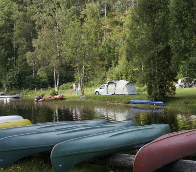
Here is the scenic Sundsbroom area with its hiking trails, bird towers, swimming, fishing and canoeing.
Färgelanda
Färgelanda is the municipality's central location, where the plastics industry is dominant. Here you will find shops, banks, post offices, liquor store, pharmacy, health centers, dental care and more.
Here is the municipal office and since 2003 Centrumhuset which houses the Employment Service, Social Security Office, Library, Citizens' Office, Tourist Office and Café.
Dalslands Folkhögskola, dating from the beginning of the 20th century, is scenic and central to society.
Högsäter
Högsäter is located 10 km north of Färgelanda and is an old station community where a commercial center and a lot of wood industry grew. There has long been a mill, concrete industry and a subcontractor for the automotive industry. In Högsäter there are shops and banks.
Järbo
The Järbo community is 5 kilometers north of Högsäter. The village is a distinctly agricultural and forestry village that lies along Kroppefjäll's western side. During the years 1793-1806, Lieutenant Carl George von Döbeln owned the farm Önne. A memorial stone was erected in 1933. In Järbo you can walk the path of Karl XII, a 12 km long trail that leads to Dals Rostock in Mellerud municipality.
Lerdal
Lerdal parish is located in the northwestern part of the municipality and most of it consists of a scenic valley where small-scale agriculture has for many years put its mark on and contributed to the beauty of the landscape. Through the countryside, the Lerdals River winds its way with its beautiful meandering trails. The farms are usually high and free on the heights along the valley. From these places you have a beautiful view out over the hillside.
The church was built in 1771 and there is a baptismal font from the 13th century. A wooden sculpture "Lerdalsmadonnan" from the 1300s was found in the church but unfortunately was stolen by a burglary in 1990. The closed school is a popular gathering place. There are approximately 180 inhabitants in Lerdal.
Nättjebacka
The Nättjebacka area, which also includes Bråten and Stora Höghult, has always been the gateway to Valbo. Here, for example, was the customs station and the national border with Denmark / Norway before the peace in 1658 in Roskilde.
The name Nättjebacka comes from the fact that here fishing nets were hung on drying for fishing in Lake Långhalmen.
Nättjebacka and Långhalmen also today offer good fishing and beautiful nature experiences, such as noble deciduous forests, pastures, mosses and mountains, as well as ancient remains and "magic stones". In the countryside there is a lively homebuilding association and homestead farm for rent at reasonable prices.
Rådanefors
Rådanefors is a small utility community just east of Stigen. There was once an ironworks started by Jöns Kock. Today, only the ruins of the ironworks remain.
Råggärd
Råggärd has a beautiful landscape with varied fields, pastures and forests. Rich bird life, moose, deer, etc. At Öje bog with high prorated nature conservation value you can see heather whistles and big spoves.
At Råggärds Church there is a larger burial ground from the younger stone age about 4,000 years BC. with a heel box and several piles. At the church there is mini golf and café in the summertime. There are opportunities to rent houses on a farm. Furthermore, there is a display garden in Åkerud and sales of goat cheese in Gässbo.
Rännelanda
Rännelanda is located 6 km west of Högsäter society. Has about 200 inhabitants. Lakes: Häresjön and Långevattnet.
The church is from the 18th century with nice views over the countryside. Emelie Flygare-Carlén lived for a time in the countryside and one of her children is buried in the cemetery. Rännelanda hometown association, with 150 members, runs an old school café every summer. Some evenings song and music entertainment as well as viewing photos from the countryside.
Stigen
Stigen is a community 5 kilometers east of Färgelanda. Society is built around the textile industry that operated from the turn of the century to the mid-1980s. Today, a small number of small businesses operate in the remaining premises. There is also a well-preserved power station here. Stig's mansion dates back to the 1820s.
Ödeborg
Ödeborg is an old utility society where much of the old Ödeborg's use is left in the form of buildings, detached villas and workers' homes. Here is the municipality's only People's Park.


