Pilgrimage on Orust Island
Orust
Hike the St. Olofs Trail between eight beautiful churches on Orust. Through trails, hilly terrain and small roads you get to experience the sea, mountains and inland.
Pilgrim Trail 90 km
Walk the St. Olof Trail between eight beautiful churches. Via paths, hilly terrain, and small roads, you'll experience the sea, mountains, and inland. Follow the St. Olof marker from pole to pole or use the digital map with GPS on your smartphone. All sections of the trail start and end at the churches. The trail's sections connect eight of the parish's churches. Here, you can park your car and have access to a toilet, and you can fill your water bottle completely free of charge. At each church, there's a paper map in a mailbox with more information and a pilgrim's passport to stamp at each church. You'll also find a place for contemplation and meditation.
Find your way
Through the digital map, you can easily find your way and your current position. It provides updated information about the trail's route, more sights, and other essential information along the way.
Sections of the Trail
Långelanda Church – Stala Church, 12 km, medium difficulty
Old pastureland with beautiful views. Here, you can stop at the Haga Runestone, a relic from ancient times. Freshly baked bread is available at the small bakery 'Herr Bröd' located near County Road 160.
Stala Church – Tegneby Church, 6.5 km, easy
Walk through farmland as well as deciduous and coniferous forests. Possibility of an ice cream break at the gas station in Tegneby.
Tegneby Church – Nösunds Chapel, 11.2 km, medium difficulty
The stretch between Tegneby and Lalleröd is easy, then becomes more hilly. Rich flora. Fantastic views over Kalvöfjorden. Easy to find a spot for camping with a tent.
Nösunds Chapel – Morlanda Church, 19 km, medium to difficult
The trail, starting at the chapel, takes us along the sea in Nösund. Varied terrain with beautiful views and opportunities for salty baths. Make a detour up to the viewpoint at Boxviks Vette and enjoy an incredible view. The packed lunch tastes best here. Possibility for overnight stays at Nösunds Havshotell and Nösundgården.
Morlanda Church – Röra Church, approx. 12 km, medium difficulty
There are beaver lodges at Hålta Vatten. In the surrounding area, there are remnants of old settlements. Plenty of nice spots for camping. Rich plant life. Fantastic view from Svens Altare. This trail takes you far away from settlements. B&B, Lilla Röran, is close to Röra Church.
Röra Church – Stala Church, 10 km, easy/gravel road
A pleasant walk mainly on different roads. Along the way, you'll find forest glades for tranquility and meditation.
Röra Church – Torp Church, 12.8 km, easy/gravel road
A nice walk mainly on different roads. Along the way, you'll find forest glades for tranquility and rest. Along the trail, you also pass 'Tomtestigen' (the gnome path). Close to Torp Church is Slussen Pensionat.
Torp Church – Myckleby Church, 9 km, medium difficulty
Three lakes trail. Varied terrain where you can take a refreshing dip before pulling out snacks from your backpack. Possibility for overnight stays in a cabin at Krossekärr or at Ålgård. At Ålgård, there's also an option to rent a canoe or kayak from Friluftsfrämjandet.
Myckleby Church – Långelanda Church, 12.6 km, medium difficulty
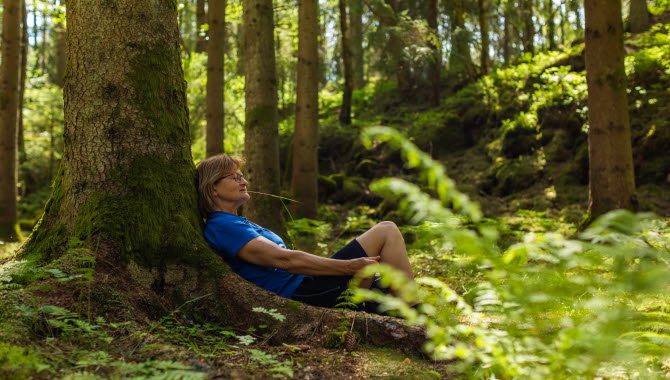
Walking through lovely coniferous forests where there are plenty of places to sit down in the soft moss for a moment of rest and peace. Possibility of a refreshing salty bath at the old Stillingsön spa. You'll also pass Stillingsön's Handel.
Photographer: Amplifyphoto/ Markus Holm
Right of Public Access
You are free to move around in nature so long as you adhere to the basic principle of “don’t disturb, don’t destroy”. Do not walk across private property. Choose places to stop and camp that are away from the trail, keep yourself updated on fire bans in force, and take your waste away with you when you leave.
Fact about the trail
Length:
The pilgrimage path at Orust connects eight churches. The trail is a total of 90 km.
Långelanda Church - Stala Church, 10.7 kilometers
Stala Church - Tegneby Church, 6.5 kilometers
Tegneby Church - Nösund Chapel, Brattebräcka, 11.2 kilometers
Nösund Chapel - Morlanda Church, 19 kilometers
Morlanda Church - Röra Church, Göksäter, 13 kilometers
Röra Church - Stala Church, 10 kilometers
Röra Church - Torps Church, 12.8 kilometers
Torps Church - Myckleby Church, 9.0 kilometers
Myckleby Church - Långelanda Church, 12.6 kilometers
Marking:
The trail is marked with the St: Olof mark.
There are information signs at each church.
Start and end:
The eight churches are good starting points, where there is parking and information signs. And toilet daytime (with the exception of Nösunds Chapel).
Map:
Here is the digital map we recommend you to use.
There are also maps available in PDF format for each section as well as an overview map.
Orust Turistinformation
Kulturhuset Kajutan
47334 Henån
Phone: +46 304 79 93 40
E-mail: turistinfo@orust.se
Website: sodrabohuslan.com


