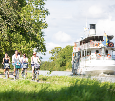
Brommö cycle trail
In the archipelago just off Mariestad you will find Brommö – an island paradise in Lake Vänern with fantastic beaches and attractive scenery. The island is virtually vehicle-free, but has a 16 km cycle trail.
Quick facts
Length:
16 km
Terrain:
gravel
Time required:
around 1.5-2 hours
Markers:
marked in counter-clockwise direction
Level of difficulty:
easy
Start and finish:
ferry terminal on Brommö
Brommö boasts a rich variety of animal and bird life and scenery reminiscent of the west coast with rocks and sand dunes. You will also find leafy woodland for picking berries and mushrooms along with meadows and fields. Parts of the island are a nature reserve.
To get to Brommö, you take the ferry from Laxhall on the island of Torsö. The ferry terminal has a car park and a bus stop, if you come by bus. You will find times for the Brommö ferry here.
Remember to pack food and drink for your outing, as there are no shops, restaurants or kiosks on the island.
Bathing and outdoor recreation
There are several excellent bathing spots on Brommö, with sandy beaches at Store Vite Sand and Rövarsand on the north side and the smaller Sandvik beach to the south. When the water level is low, you can wade across from Rukehamn to picturesque Hovden, for more bathing options. The bathing spots also have wilderness shelters, dry toilets and ready-made fire pits.
Wilderness shelters can be reserved: tel. 010-471 80 11.
In addition to the cycle trail, there is also a 14 km marked hiking trail on the island.
Facts about the trail
Length:
16 km
The trail is a complete circuit.
Estimated time:
1.5-2 hours, at normal cycling speed with no breaks. However, plan for numerous stops for bathing and/or berry and mushroom picking, to enjoy the view and the wildlife.
Markers:
The trail is signposted in a counter-clockwise direction.
Level of difficulty:
The cycle route is easy and level and runs on gravel roads.
Start and finish:
The trail is a loop that starts and ends at the ferry terminal on Brommö. The ferry to Brommö goes from Laxhall on Torsö and takes around 5 minutes. In low season the ferry must be booked in advance (no later than the day before). Torsö is north of Mariestad (30 minutes by car). There is a free car park at the ferry terminal, as cars are not permitted on Brommö. Bus service 511 runs on weekdays between Mariestad and Laxhall. For departures, visit www.vasttrafik.se
Getting here:
The island of Brommö lies in the Mariestad archipelago in Lake Vänern, in the heart of West Sweden. It is 30 minutes north of Mariestad by car. West of the island of Torsö and north of the town of Mariestad.
By car:
From Mariestad take the E20 north. Follow signs for Torsö, go over the bridge and then follow signs for Laxhall/Brommösund.
By bus:
From Mariestad, around 50 minutes with bus 511 (stop Laxhall), www.vasttrafik.se
Map:
Maps are available from Mariestad’s citizen’s office (medborgarkontor), Laxhall Hamnkrog & Restaurang and Glasmagasinet on Brommö.
Contact information
Mariestad Municipality
Kyrkogatan 2
542 30
Tel: +46 501 755850
E-mail: Send e-mail
Lexhall Hamnkrog & Konferens
Restaurant, relaxation, cottages and camping pitches on Lake Vänern’s largest island


