({{search.Data.length}} results)
{{settings.Localization.Data.SearchResult.EmptySearchResultSuggestion}}
Part of

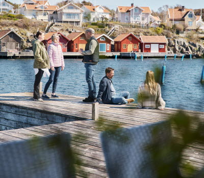
Photographer: Södra Bohuslän Turism, Anders Jonsson

Orust Tvärs / Coastal Trail
Svanesund - Ängön

44 km moderate-challenging

The Coastal Trail Orust, also known as Orust Cross, is a 44-kilometer-long nature and culture trail from coast to coast. The hiking trail is part of the Coastal Trail that runs through the entire Bohuslän region

Along the trail, there are many cultural and natural landmarks, providing both a nature and cultural geographical experience. The hiking trail stretches between the municipality's eastern and western coasts, reaching more than 100 meters above sea level at certain points. Along the path, there are 64 signposted cultural and natural landmarks, offering insights into the development and changes in the cultural landscape of Orust.


Photographer: Amplifyphoto/ Markus Holm


Svanesund – Hoga, Part 1

The first part of the Coastal Trail in Orust, or Orust Cross, runs between Svanesund and Hoga. Svanesund is a small community with a grocery store, making it a suitable place for provisioning.

After Svanesund, the trail leaves the asphalt and initially passes through overgrown, gently rolling cultivated land. A few kilometers into the stage, you'll come across the Cultural Trail in Kultehamn. Here, several ruins bear witness to harsh living conditions.

The trail continues through a hilly forest landscape, heading towards Borrefjäll. Here, there's a detour to the remains of an ancient fortress. From here, the trail follows gravel roads down towards Highway 160, which crosses Orust. The stage ends at Hoga, where you'll find a larger parking lot and an ancient runestone. Nearby, there's also a bus stop.

Hoga-Göksäter, Part 2

The second part of the trail goes from the runestone in Hoga to shopping in Göksäter. There is a parking lot and a bus stop at Hoga. From here, the trail heads west across Orust, passing through open forests and cultivated landscapes, past both overgrown fields and fields still in use. Soon, the trail passes three large wind turbines and continues on an old church road towards Göksäter. In Göksäter, the trail returns to asphalted roads. Here, you'll find the Göksäter store with the option to have coffee or lunch in the café, or purchase snacks and beverages in the store.

Göksäter-Malö Strömmar, Part 3

The third part takes you to Svens Altare with a fantastic view and further to the ferry dock at Malö Strömmar on the northwest of Orust.

The stage starts in Göksäter and heads west through open cultivated landscapes and forests. After a few kilometers, the trail reaches the beautiful lake Rödsvatten. Here, the trail becomes more hilly and climbs to the top of Slottsberget and the viewpoint Svens Altare. Here, you're rewarded with a fantastic view of the sea. The trail now turns south and, after another 1.5 km, reaches the lake Håltavatten. The trail then passes a series of old cottage ruins, reminiscent of the hard work in this barren area in the last century. The path continues through the deep valley of Lunneklev towards Morlanda, where the landscape opens up, and the trail can continue on smaller roads down to the ferry dock at Fröjdendal, where the ferry crosses Malö Strömmar.


Flatön, Malö Strömmar – Ängö, Dragsmark Ferry Terminal, Part 4

From the ferry terminal at Malö and along the islands Malö, Flatö, and Ängö.

The stage begins at the ferry terminal near Malö Strömmar and crosses Malö, then heads northeast across Flatön.

The trail follows a mix of roads and paths. In the middle of Flatön, just after the School Museum, the trail traverses a fairly hilly terrain and crosses a small bay where a series of stairs, a bridge, and railings make it more accessible for hikers.

The stage concludes at the next ferry terminal, at Ängö, heading towards Dragsmark.

Read more about Kuststigen.

Fact about the trail

Length:

The entire trail is 44 km

Svanesund – Hoga: 11 km
Hoga - Göksäter: approximately 11 km
Göksäter – Malö Strömmar: 13 km
Flatön, Malö Strömmar – Ängö, Dragsmark Ferry Terminal: 9 km

Marking:

The trail is marked with blue color on poles. Along the trail, information about interesting places and objects is provided.

Level of difficulty:

Svanesund – Hoga Moderate Surface: Asphalt, gravel, and forest path

Hoga - Göksäter Moderate Surface: Gravel road and forest path

Göksäter – Malö Strömmar 13 km Challenging Surface: Gravel road, asphalt, forest path

Flatön, Malö Strömmar – Ängö, Dragsmark Ferry Terminal 9 km Moderate Surface: Gravel road, asphalt, forest path. 

Contact information

Orust Turistinformation

Kulturhuset Kajutan

47334 Henån


Phone: +46 304 799340


E-mail: turistinfo@orust.se