
Storspåret
Åmål
A 20 km long hiking trail that starts at Hanebol, Åmål and ends up in Edsleskog where it connects to the Pilgrim Trail. Along the way there are several camp sites.
Hiking trail
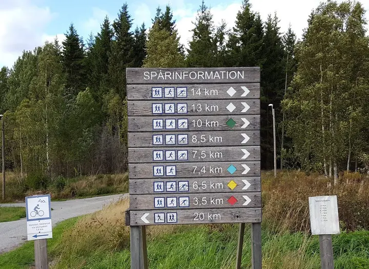
Length: 20 km
Type of trail: Straight
The hiking trail is signposted and takes you on narrow paths, tractor roads and gravel roads. You pass several beautiful lakes and there are many nice places to stop. You can take the bus between Edsleskog and Åmål.
Directions
- Start at Hanebol, where there are many hiking trails, and follow signs that say "Storspåret".
- After about 3.5 km you cross the road 164 at Korsbyn. Then the trail continues on smaller trails, tractor roads and gravel roads.
- After 9.5 km you will reach The Bergtjärn hut camp site at Bergtjärnet.
- After 11 km, you arrive to Handskesjön which is beautiful place with a hut and camp site next to the lake. Then it's just about 9 km to Edsleskog, along paths and smaller gravel roads.
- 14 km from Hanebol you will reach Rådanetjärnet. There's information board with trail description to Ängebytjärnet, about 3.1 km marked trail. From Ängeby there are several marked trails and fishing possibilities available.
- Once you get out on the asphalt (after about 400 m), continue on the dirt road between the lakes Bräcketjärnet and Knarrbysjön and past the farm Näs.
- After a total walk of 20 km, you arrive at the parking lot at Höghedens ski slope.
Keep in mind that Storspåret also is a cycle path and that there may be MTB bikes riders on the trail.
Continue your hike on the pilgrim trail
The Pilgrimsleden in Dalsland is a varied hiking trail that takes you through the entire landscape from Edsleskog in the north to Vänersborg in the south. A trail over 100 km long, through the Dalsland wilderness and further over the the countryside of Dalboslätten.
Photographer: Gaby Karlsson Hain
Stay the night
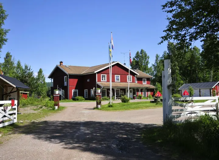
Åmåls stadshotell
Beautiful turn-of-the-century style hotel in the middle of central Åmål. About a 30-minute walk or 5-minute drive from the Hanebol outdoor area where the trail starts.
amalsstadshotell.se
Dalhall Hotell
Nice hotel by road E45 outside Åmål. About 5 min drive from Hanebol outdoor area.
dalhall.se
Edsleskogs Wärdshus
Nice family-owned hotel by Lake Edslan in Edsleskog.
edsleskogswardshus.se
Åmåls Kommun
Västra Åsenvägen 10
66235 Åmål
Phone: +46 053217000
E-mail: kommun@amal.se
Website: amal.se