


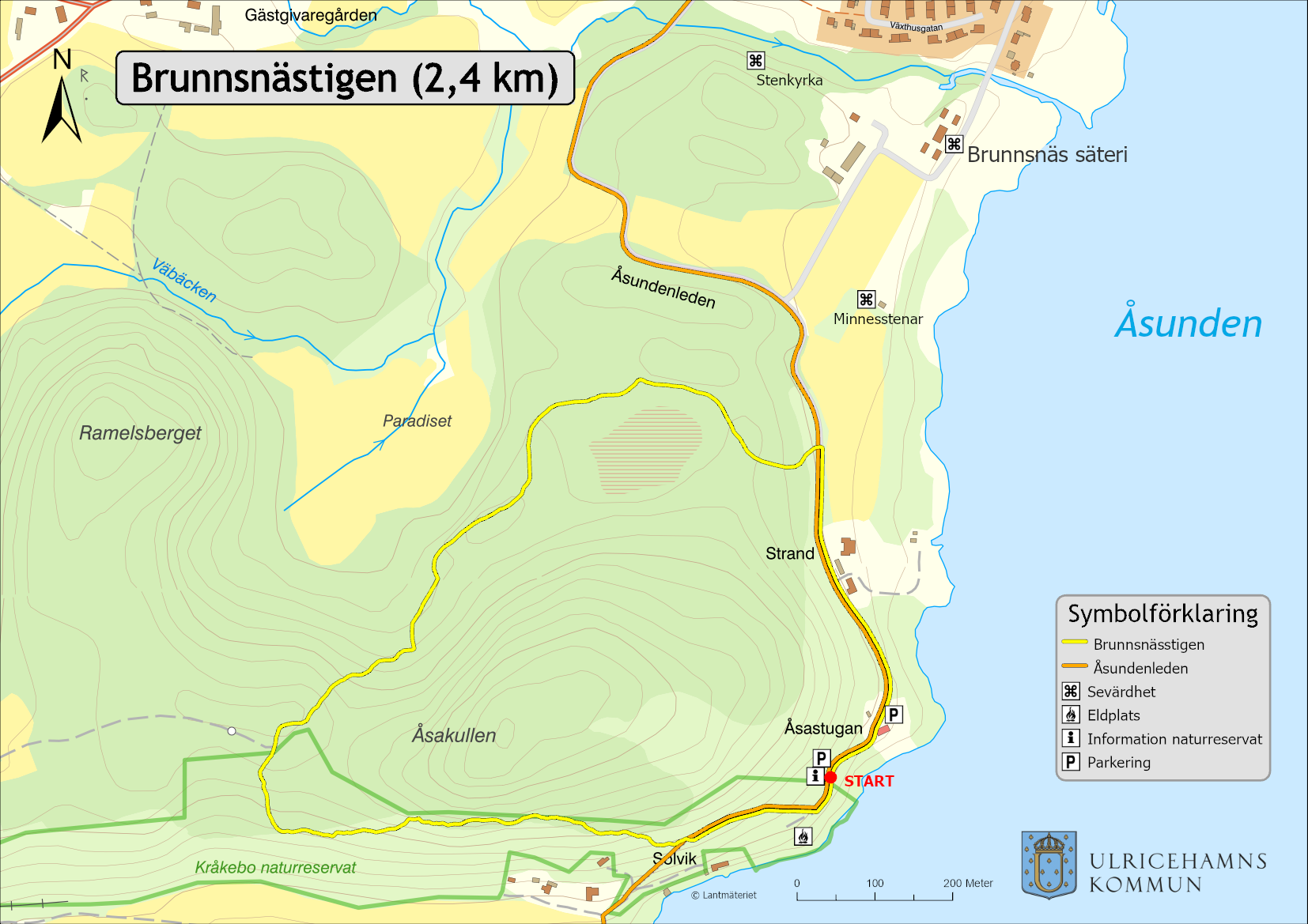
Brunnsnäs Trail
Ulricehamn
Feel your legs being used on this hilly trail, by the slope to Kråkebo nature reserve. At the same time, you can enjoy the beautiful nature that the western part of Åsunden has to offer.
Welcome to The Brunnsnäs trail on the west side of the lake Åsunden. The trail, which is a circular loop, is located in the popular nature area Brunnsnäs near Åsastugan. The Brunnsnäs trail starts at the entrance to Kråkebo nature reserve.
Fact about the trail
Length:
2,4 kilometers
Area:
Brunnsnäs
Think about:
Parts of the path go near precipices. Therefore keep an eye on children.
Two tips:
- A fireplace with a beautiful view of the lake is located just south of Åsastugan.
- Feel free to walk the path counterclockwise. This way you will more easily get a glimpse of Åsunden along the southern part of the path.
Marking:
The path is marked in yellow
Level of difficulty:
Medium difficulty. Hilly path
Suitable for:
Anyone who is not afraid of heights or has difficulty walking.
Start and end:
The path goes in a circular loop and starts at the entrance to Kråkebo nature reserve.
How to get here:
Kråkebo nature reserve is located between Brunn and Tvärred on the west side of Åsunden just outside the center of Ulricehamn.
Map:
This link leads you to a map with approximate position: