Walking on North Koster
Strömstad
North Koster, one of the lovely Koster Islands, offers coastal walking in dramatic landscapes. Walk over heaths and through small forests to glacial erratic fields and salty swims.
Quick facts
Length: 5.5 km
Timing: approx. 2 hours
Difficulty: moderate
Terrain: nature trails, heaths, woods, beaches and meadows
Sweden’s first marine national park
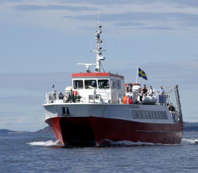
A long way north on the coast of Bohuslän, just off Strömstad, lie the popular Koster Islands, surrounded by the Kosterhavet National Park, Sweden’s most species rich sea area. The coastal scenery on and around this group of islands is simply stunning. The Kosterhavet sea became the first marine national park in Sweden in 2009. It’s easy to get to the two main islands, North and South Koster on the Koster Boats which leave from the north harbour in Strömstad all year round.
Photographer: Örjan Karlsson
Impressive fields of glacial erratics on North Koster
Explore North Koster’s dramatically varied landscapes on two round walks. The white route is 5.4 kilometres and the orange route 5.5 kilometres. The last Ice Age has left impressive traces behind in the form of a field of glacial erratics at Valnäsbukten, which is definitely worth seeing. The marshlands at Valnäs are also home to the rare Seaside Buttercup, called Bohusranunkel in Swedish.
The best swimming spots are in Basteviken, Norrvikarna and Hasslevikarna. From the lighthouse at Högen, the highest point on Koster, there’s a spectacular view. On a clear night you can see the sun set behind the Norwegian fells to the north.
Photographer: Örjan Karlsson
Fact about the trail
Length:
On North Koster there are several trails to choose from. If you want to walk round the island choose the 5.5 kilometre long orange path. There’s also a white path which is 5.4 kilometres.
Marking:
The paths are marked with oak posts coloured orange or white for each respective trail, and arrows at crossroads. Boards with maps of the routes can be found on the island’s main jetties and certain spots along the route and you can pick up printed maps in the Tourist Information Centre in Strömstad, on the Koster Boats, on the jetties on Koster and outside the naturum Kosterhavet visitor centre.
Level of difficulty:
The paths are classed as moderate and are mostly on nature trails in varied terrain, over open heaths, along beaches and through fields. The mobile app “Vandring I Kosterhavet” gives a good overview of the different routes and terrain.
Start and end:
Both walks start on the Västra Bryggan (West Jetty). Ferries leave from Strömstad’s north harbour and take between 30 and 60 minutes. If you want to continue walking on South Koster a cable ferry runs between the islands during summer.
Photographer: Åsa Dahlgren
How to get here:
The Koster islands are just off Strömstad, and can be reached by boat all year round. Strömstad can easily be reached in under 2 hours by car from either Gothenburg or Oslo. Train from Gothenburg takes approximately 2.5 hours. The ferry leaves from Strömstad’s north harbour and takes between 30 and 60 minutes. To walk on North Koster get off at Västra Bryggan where both walks start from. In summer it can be difficult finding parking in the centre of Strömstad, but the long stay car park at Hålkedalen, Strömstad’s secondary school and Bojaren, all close to the roundabout at the approach to the town are good alternatives. Free shuttle buses from the car parks to the centre run during summer.
Map:
A digital map of the paths can be found on Google Maps.
Naturum Kosterhavet
Hamnevägen 30
452 05 Sydkoster
Phone: +46 10 224 54 00
E-mail: Send e-mail
Website: kosterhavet.se


