Kuststigen Skaftö
Skaftö
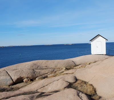
Some cycle and hiking trails on Skaftö partly coincide with Kuststigen, the coastal trail in Bohuslän. Kuststigen winds its way out on Skaftö and gives you an intimate experience of the rustic farmlands in the coastal region of Bohuslän. The winding trail takes you through forests, pittoresque villages and over hilltops with breathtaking views. All distances are suitable for day hikes.
Quick facts
Length: trails fråm 314 m to 6.8 km. All trails in total 20.3 km
Timing: You can walk parts of the coastal trail or combine your hike with other trails
Difficulty: Moderate
Terrain: Mostly solid nature trail but partly combined with bike paths
Hiking and biking along the blue Kuststigen
The hiking trail Kuststigen is marked with blue colour markings on poles. Along the trail, information is provided about places of interest and objects. From the bridge over to Skaftö it initially winds around on both sides of Skaftö before it extends and coincides with a cycle path from Östersidan via Fiskebäckskil and Stockevik to Grundsund.
Discover Skaftö along Kuststigen
Near the bridge over to Skaftö you will pass Skaftö wind mill and of course the nature reserve at Vägeröd. Further ahead is Fiskebäckskil, an old shipping society, with well-preserved buildings from the 19th century. The artist Carl Wilhelmsson's villa is also located in Fiskebäckskil, near the beach Bökevik. Further along Kuststigen you will find the meadow Gröderhamn, a nature reserve rich with orchids in June. At the far end of Skaftö and Kuststigen you will reach Grundsund, a picturesque fishing village.
Fact about the trail
Length:
Fiskebäckskil - Grundsund 6,8 km
Gröter äng 314 metres (Gröderhamn)
Sälvik - Edsvattnet 2 km
Vägeröd - N Skaftö 6 km
Östersidan - Vägeröd 1,4 km
Fiskebäckskil - Östersidan 3,4 km
Evensås 820 metres
In total 20,7 km
Approximate times:
The coastal trail Kuststigen can be combined in different ways and is perfect for day hikes.
Marking:
Blue marking on poles and the symbol for Kuststigen and sometimes even blue wooden flashes.
Level of difficulty:
The terrain varies from gravel roads, cycle paths, stony streets through a village to nature trails.
Start and end:
You can combine parts of the trail as you wish. Perfect for day hikes. A good starting point is at the ferry stop at Östersidan, another is at the petrol station at Roskällan between Östersidan and Fiskebäckskil. Easy to park if you come by car.
How to get here:
The passenger ferry Carl Wilhelmsson (Västtrafik 847) from Lysekil docks at both Östersidan and Fiskebäckskil. The bus (Västtrafik 845) serves all over Skaftö with stops along the way.. If you come by car, parking spaces in the villages are scarce during the summer. Guest harbours are located in Fiskebäckskil and Grundsund.
Map:
You can find a route map on Google maps and if you want a printed map, it is available at Infopoints in Lysekil municipality.
If you are interested in more scenic hikes on Skaftö - check out Skaftö – en livslång kärlek with a map which is also printable.


