Trailhättan
Trollhättan is a city that has many nature areas close to the city center. Here you can find many popular hiking, running and mountainbike trails that are perfect for either a relaxing walk or a sweaty workout. Follow the waters of Göta River in Älvrummet or try out a mountainbike trail at Skidstugan in Strömslund. Or would you rather enjoy the calm nature around the Ryrbäcken brook or a run in the forests of Slätthult. Let us inspire you to enjoy a visit to "Trailhättan".
Outdoor Map of Trollhättan
Get the best overview of all nature areas, major hiking trails, bike paths and more with the city's own Outdoor Map. The map shows both the city of Trollhättan and the whole municipality so you can easily find the nearest outdoor area to you.
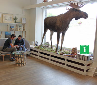
You can either come by Trollhättan Tourist Center and get a physical map or you can download a digital version of the map here and start planning your outdoor adventures in Trollhättan immediatly.
Älvrummet
Explore the dramatic landscape along the Göta River
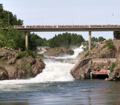
The Göta River flows through Trollhättan from north to south and has played a large role in the history of the city. The dramatic landscape that has been formed along the river is perfect to explore on foot as there are many trails to choose from that goes through the area. The nature reserve of Älvrummet is located very close to central Trollhättan and is therefore very easy to reach if you visit the city.
If you are looking for a challenge together with a fantastic nature experience then Edsvidsleden Trail is a perfect trail for you. Edsvidsleden is a 14 kilometers long trail offers magnificent views, relaxing paths along meadows and hilly terrain. There are also a couple of shorter hiking trails in the area, the popular Kärlekens stig Trail (The Path of Love) where you walk along the waters of Göta River and Träbrostigen Trail that is a more uneaven path that goes in the inland area of Älvrummet. These two trails can easily be combined to a single hike that is around 2.5 kilometers long.
There is also three trails in the area that are good option if you want to know more about the history of the area and important places that are spread out along the river. These are the De Laval Walk that goes around the Trollhättan Waterfalls, Vilhelm Hansen Walk that goes aroun the old Olidan hydropower plant and Nils Ericson Walk that takes you around the Locks area of Trollhättan. Each trail has a broschure that tells you what you see along the way. The broschures can either be found at the Trollhättan Tourist Center or downloaded below.
Skidstugan, Strömslund
Run, bike and walk in the beautiful forest area north of Trollhättan
Skidstugan, or the ski lodge, in Strömslund is located in the northwest corner of Trollhättan and offers several forms of exercise for everyone who wants to go out for a refreshing walk, run och bike trip. There are trails with electric lights (swe. elljusspår) regular trails and trails for mountainbike. At the lodge you will also find an outdoor gym where you can warm up before, or round off the day's training. The trails are gravel and wide, except for parts of the 10 kilometer trail that goes in smaller paths in some areas.
The trails consist of many short slopes and challenging paths that are guaranteed to get your muscels working. There are several trails with electric lights; 2,5, 3,5, 5 and 6 kilometers. There is also a 10 kilometers regular trail where about 5 kilometers are made up of smaller paths. If you want to ride your mountainbike there are no less than five trails with different difficulties; 1,4 km (normal), 1,7 km (easy), 1,9 km (hard), 4 km (normal) and 8 km (hard).
Slätthult
Popular nature area with trails for running, walking and biking
In the southern area of Trollhättan there is a forest covered area called Slätthult where you can find trails suitable for guests wanting to exercise in beautiful nature or just take a quiet walk. Here you will feel like you are far out in nature despite the residential area Skoftebyn not being far away. The trails are gravel and wide.
There are trails with electric lights that are 1,8 and 3,5 kilometers long and regular trails that are 2,5, 5 and 7,5 kilometers long. There are also trails suitable for mountain biking. A track map is posted at the track center.
Ryrbäcken
Take a relaxing trip along the Ryrbäcken brook by foot or by bike
The nature reserve Ryrbäcken consists of a lush brook ravine with rich bird life and interesting flora. Visitors will find a unique natural environment with easily accessible walking paths. The area is also rich in cultural relics such guant's kettles, millstones and traces of the old Queen Kristina's (1626-1689) postal route that went past this area. The area is perfect for a relaxing walk, bike ride or a refreshing run in the middle of the old forest where you can see how nature changes between the seasons along the brook water.
With its location so close to urban areas, Ryrbäcken is popular with the residents of Trollhättan and there are several paths in the area to choose from.
Slättbergen
Walk or run alongside the 600 million year old bedrock
Slättbergen Nature Reserve contains remarkable geological formations by way of flat rock surfaces. These so called peneplains are more than 600 million years ord and form part of an ancielt crystalline basment. If you want to explore this ancient area there are many good trails that can be used both for walking and for running.
Slättbergen is actually divivided into tree different areas; Hjortmossen that is located close to central Trollhättan, Eriksroparken just south of Hjortmossen and Sandhem-Halvorstorp that are in the eastern part of Trollhättan. Sandhem-Halvorstorp is the largest of the three areas but all three have many good trails to explore.
Trollhätte Canal
Follow the ships on their journey along the canal in Trollhättan
Trollhätte Canal allows ships to travel past the mighty Trollhättan Waterfalls on their way either north towards Lake Vänern or south towards Gotenburg and the North Sea. Along the canal there are several pleasant walking paths that are often used by both locals and visitors to the city to take a relaxing walk or a run after work.
Three popular trails are the so-called Trollhättan Canal Trails. They are the Spikö Trail (2,5 km), Innovatum Trail (5 km) and the Locks Trail (7,5 km). The longest one, Locks Trail, runs all along the canal from the city center in the north to the locks area in the south and back again. There is also a Path of Health in Trollhättan that will give you a wonderful 4 kilometer trip along the northern part of the canal.


