Hälsans stig
Trollhättan
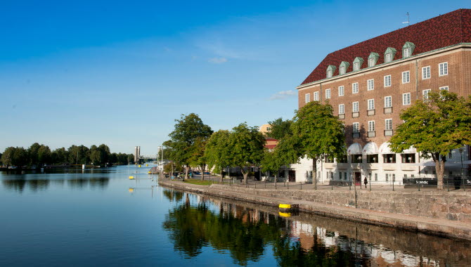
Hälsans Stig (Path of Health) in Trollhättan is a wonderful walk in a varied environment by the Trollhätte canal near the center. The 4 km long walk offers beautiful environments, interesting sights and a pleasant walk for the heart.
Quick facts
Length: 4 km
Time required: 50 minutes
Difficulty: easy
Terrain: mostly flat roads that are either paved or dirt paths.
Slí na Sláinte at Trollhätte canal
In 1995, Ireland established the first Path of Health (Slí na Sláinte). The idea is to inspire exercise for the sake of public health. Hälsans Stig in Trollhättan is a lovely walk that takes you around the northern part of the Trollhätte canal on both sides with an urban environment along Strandgatan street and a park and natural environment on Spikön island.
If you are in the city center, a suggestion is to start your walk on Strandgatan street, which runs along the Trollhätte canal. Here you can either choose to go north towards Folkets Park (Peoples Park) or south towards Klaffbron bridge. If you go south you will pass a number of bridges, one of them is Strömkarlsbron bridge where the famous statue Strömkarlen is located. Strömkarlen is a local version of Näcken (Neck – water spirit), deep inside a friendly figure but who punished those who came to the city to cause mischief.
Then go north along the water, over the Spiköbron bridge and then turn left and have a nice walk along Spikön, the green oasis that is surrounded by the waters of the Göta River. Here is, for example, a summeropen café, a playground and a duck pond. You then cross the railway bridge and back on the eastern shore you go through Folkets Park in Trollhättan before you turn south again and return to Strandgatan street.
You can of course also start your walk wherever you want and what is extra good about Hälsans stig is that you can count for yourself how many kilometers you have walked thanks to the signs that are set up at each kilometer. The trail is a total of 4 km.
Photographer: BildIT
Sights along the way
Following Hälsans stig is not only good for health but it is also a nice way to discover several popular places in Trollhättan. Below you can read about some of them, a complete list can be found on the map in a printable PDF a little further down the page or on the digital map.
Lunnen - Park facility with old oaks, in addition there is a so-called arboretum with unusual tree species and fine plantings.
The railway bridge - When the railway came to Trollhättan in the 1870s, the first openable bridge was built over the canal here. Since 2001, there is a so-called lifting bridge, which is unusual in Sweden.
Ekeblad lock - The upper of the three locks that Christopher Polhem worked with in the middle of the 18th century. Used only once in 1754 when King Adolf Fredrik and Queen Lovisa Ulrika passed through here.
Nordkap - The city's oldest house, built in the 18th century, which was originally an inn but today is a private residence. The house got its name because it is located on a cliff.
Villa Elfhög - Built in 1880 and was the home of Antenor Nydqvist, one of the owners of Nohab. The house is inspired by French castle architecture.
Fact about the trail
Length:
The entire walk is 4 km long.
Approximate times:
A walk at a leisurely pace takes about 50 minutes.
Marking:
Every kilometer along the walk is marked with a yellow "Hälsans stig" sign. Signs are available at Spiköbron bridge, Strandgatan street , Spikön island and Folkets Park.
Level of difficulty:
The walk is mostly on a paved street or smooth paths, minor height differences occur.
Start and end:
Start your walk wherever you want along the path, a suggestion is to start at one of the four signs.
How to get here:
Hälsans Stig runs right by the Trollhätte canal in the center of Trollhättan and is easy to find. If you are in the center, you can walk on the path by Strandgatan street that runs along the canal and is only about 300 meters from Drottningtorget square.
Map:
You can see a digital map of Hälsans Stig on Google Maps here.
There is also a printed map that you can get at Trollhättan's tourist office or download as a PDF here.
Trollhättans Stad
Gärdhemsvägen 9
461 83 Trollhättan
Phone: +46 520 49 50 00
E-mail: Send e-mail
Website: To homepage


